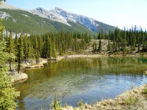
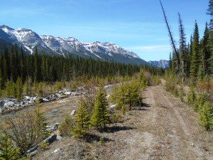
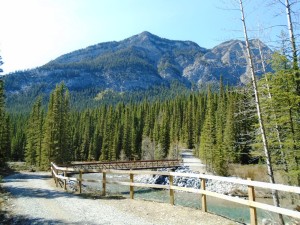
Goat Creek is one of my all-time favourite trails, and May 1st is the earliest I’ve ever biked it. I don’t get my fill of skiing Goat Creek in the winter, so I need to bike it a few times every summer as well. It’s as dry as I’ve ever seen it.
Goat Creek trailhead above Canmore had 10,000 vehicles in the parking lot and they were lined up for half-a-kilometre on each side of the road. I assume most of these vehicles belonged to hikers who were going up to Ha-Ling peak. I only encountered about 20 bikers/hikers on Goat Creek and High Rockies.
After 900 metres on Goat Creek, I made a detour onto the newly-built High Rockies trail to see if it was muddy or dry. I was only able to go 1.5K before it became too muddy for my liking. I suppose a die-hard mountain biker would have continued, and I could see the tracks of others, but I don’t find it to be much fun, not to mention the damage it does to the trail.
The Trans Alta osprey is back on its nest. There’s a tall pole near the power station where the nest is visible and one of the birds was chirping. Not sure if they have eggs or if they are just renovating in preparation.
To an osprey, a power pole is a perfect nesting site, so commonly, in order to not electrocute the birds, power companies build nesting platforms near the powerlines as a safer alternative.
Back up to Goat Creek where the trail was in excellent shape. Any low spots with mud were easily skirted and I didn’t get any splatter anywhere. The trail only became drier as I approached Banff.
Goat Creek ends at 9.5K at which point it connects to Spray River West and takes you to Banff. The total distance is 19K.


Your mention of High Rockies Trail aroused my curiosity so the last few weeks I have managed to walk it from Driftwood to West Wind then on to Spencer Creek today to Sparrowhawk and Spray Lakes campground. http://kananaskisblog.com/high-rockies-trail/2015/ The website is excellent and I think all of the north map is completed. Today walking in some 4-5″ snow, it felt great getting some snow falling off the trees onto my head. Many sections were bare earth and not muddy surprisingly. Made a pathetic snowman where the snow was heaviest, and assume this will be a multi-use trail. Saw some old bike tire tracks and one grouse, who flew up to the nearest tree. Hope he does not take lessons from the Pocaterra grouse.
They have done a terrific job building this trail and I reflected how beautiful it was to see such a great trail be created after the serious flooding of all those creeks 3 years prior. For walkers wanting to explore it, suggest starting at Driftwood and coming out at Sparrowhawk or Spray Lakes area and hitch back to your cars. My next portion to explore will be Spray Lakes to Buller, which will be closed in winter due to avalanche risk. Could not help wondering if this will turn into a terrific light touring x-c ski trail in winter, but the early bird will likely get the best snow since it will become popular with snow-shoers and fat tire bikers. Parking on the Smith Dorrien in winter could prove problematic for Volker Stevin people, who keep that road in superb condition.
Re cycling
Apparently Highwood Pass has been snow free for a while!
See you there tomorrow?
Great report, as many XC skiers also cycle your reports are most helpful. Was just thinking of trying the trail.