
I don’t think I could have picked a better day to ski in Cypress Hills. Beautiful weather, fresh tracksetting and a new and exciting discovery(Ferguson Hill).
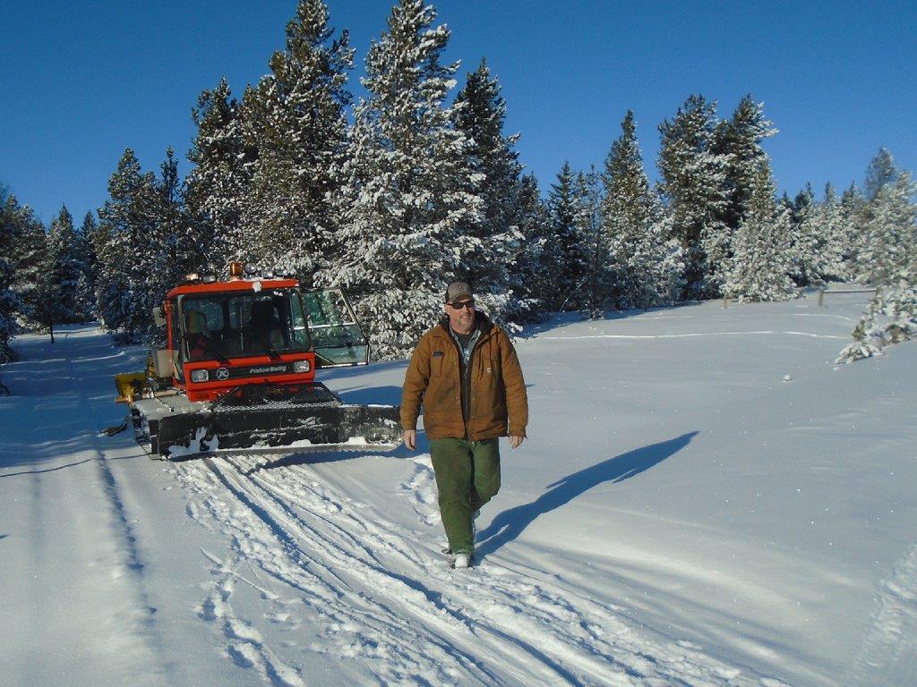
Tracksetter Darwyn
Cypress Hills is about a 45-minute drive from Medicine Hat. The main trail system, the Spring Creek trails, is a short drive up the hill from the town of Elkwater, and is at an elevation of 1430 metres, about the same as the Canmore Nordic Centre.
 There is a coffee shop in Elkwater named The 12-34 Cafe where I had lunch today. What’s in a name, you ask? 1234 is the elevation.
I was happy to meet Tracksetter Darwyn as he was grooming the Spring Creek trails with the Pisten-Bully snowcat which was formerly used at Ribbon Creek.
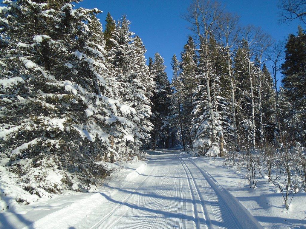
One of the long but easy downhills on the Spring Creek trails
The temperature at 12 noon was -6 and as you can see in the photos, it was a bluebird day. Blue skies and blue wax. There was a breeze at the hut when I started out but once in the trees, the air was calm.
Unfortunately the wind is bringing in warm air, so I don’t know how long these wonderful conditions will remain.

Peter Butler on the access trail
It was a pleasure to run into a former Foothills Nordic Ski Club member, Peter Butler, who lives in Medicine Hat now. In the photo, you can see Peter on the access trail. To reach the Spring Creek trails, there is a 1.1K groomed trail(not trackset) from the hut and parking lot.
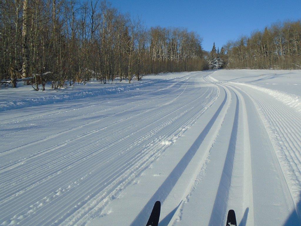
The Spring Creek trails would be considered easy. There are no big hills, but there some long inclines which are very enjoyable to descend without white-knuckling it or even snowplowing. There’s an 80 metre elevation difference between the high and low points.
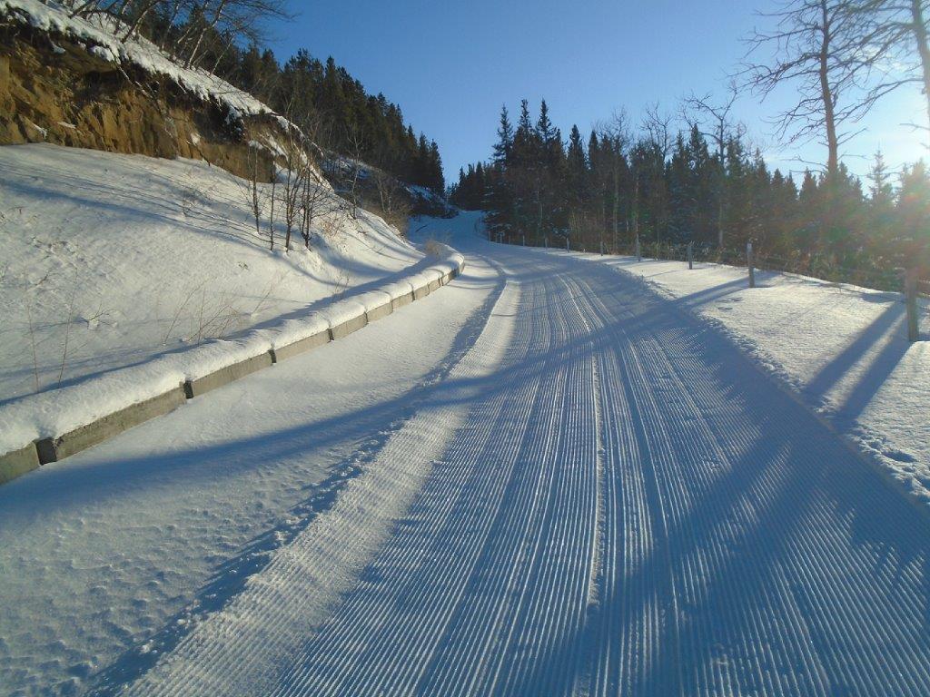
The Cypress Hills version of North Lookout or maybe Skogan Pass
The perimeter loop, including the access trail, hut to hut would be 9.3K but you can add to the fun by doing the two trails which criss-cross the system. You can also make a shorter loop.
In addition to the Spring Creek system, there are other groomed trails at Cypress Hills and I was thrilled to discover Ferguson Hill today. If the trails at Spring Creek are too easy for you, check out Ferguson Hill.
Ferguson Hill
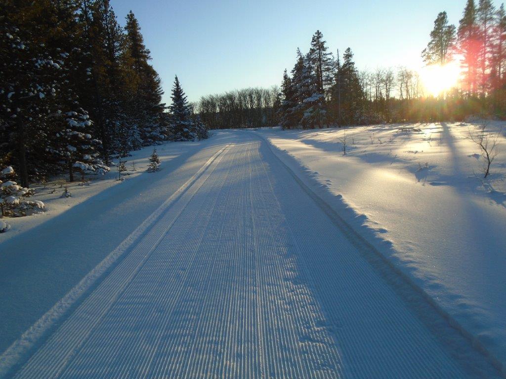
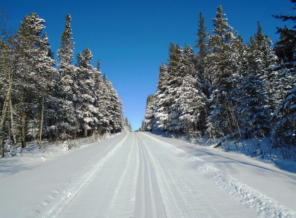
Approaching the top of Ferguson Hill
Ferguson Hill starts in the Elkwater townsite and climbs 225 metres over a distance of 3.2K.
The first 600 metres of distance has a net elevation gain of 80 metres. That’s Skogan Pass or Kananaskis North Lookout steepness. The remainder of the trail is very pleasant with a constant elevation gain but nothing scary on the way down, just enjoyable cruising.
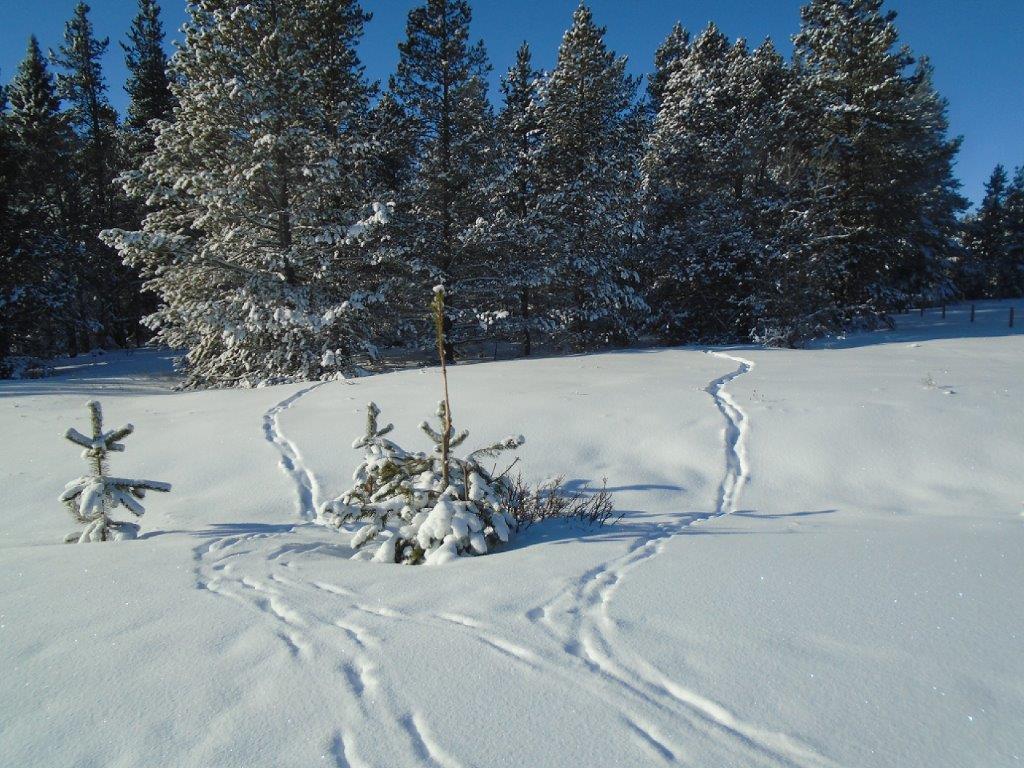
Animal tracks
Ferguson Hill is groomed but not trackset, which is standard fare for steep trails.
With warmer temperatures in the afternoon, I added a layer of VR45(-2/-8) and didn’t have to herringbone, not even once, on the climb.
The climb took 45 minutes. The descent took 12 minutes and I was being very deliberate on the steep part. My GPS said my maximum speed was 40 KmH, but I could have easily reached 60 with some risky behavior.
At the top of Ferguson Hill, the trail turns left onto Murray Hill road which is also groomed and connects to the Spring Creek trails. It was very windy by this time at the high elevation and being somewhat exposed, I didn’t proceed any further.
Not to spoil the “surprise”, but Ferguson could definitely be on the Hill Pain hit list! From my data in the summer, steepest 1km is 10%, parts of which tickle 20%, and the avg. gradient for the 3.1KM is 7%. It’s no Alpe Cermis, but it’s in the top 5 toughies ’round these parts for sure.
According to the Alberta parks PDF winter trail brochure, there is a perimeter loop connecting east and west sides of the spring creek trail system that goes down and around the town site using horseshoe canyon trail (or ferguson hill), the shoreline trail and ridgetop trail. The map doesn’t show the ferguson hill trail or that it is a road that is closed in winter. Presumably one could do a big loop, perhaps with a bit of walking, and/or be able to access the spring creek trails from town without driving and getting more hill workout. Worth noting that the map transposes the colour labelling for snowshoe vs. Ski trails. I tried attaching the link to the brochure, but couldn’t get that to work. Perhaps there are more trails to the east also, in the direction of reesor lake? Certainly some on the Saskatchewan side. If enough trail distance for a multi-day stay, I’d go there for sure.
MaSid, you could do a loop with a minimal amount of walking. I estimate it would be around 18K. The snowcat uses the shoreline to access Ferguson Hill from the maintenance compound. Here’s a photo of the shoreline showing the cat tracks.
Elkwater Lake shoreline
Stoke the fire at the hut then, I’ll be there shortly, after the winds die and a bit more snow. Thanks bob for reporting the details of this destination, helps us all plan a potential trip!
It’s great to see my old PB still laying down some nice track. I went up to Cypress a few years ago to train Darwin on how to operate it and set track. That system was just getting started then. I’m happy to see it up and running as it had lots of potential. Thanks for posting Bob.
And I’m still trying to remember all you taught me!!
Looks pretty good from Bobs pics. You learned well grass hopper.
Thank you very much! Just goes to show that you can teach an old dog new tricks.
Wow! Ferguson Hill is news to me! It’s great to cycle in the summer. If the snow stays over Christmas such top notch grooming just might warrant a trip from the Capital.