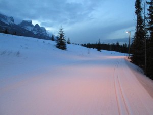
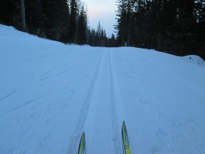
It’s been 18 long days since I skied on waxable skis, and last night at the nordic centre it felt like I was going at supersonic speeds.
It sure felt good to be on cold snow again. Waxless skis are fine when you have wet snow but there’s no better feeling than smoothly gliding along on my waxable skis on firm, fast tracks. The air and snow temperature were both -11°C at 7:15 pm.

With the colder weather, there should be some great ski conditions at Canmore Nordic Centre this weekend
The tracks and skate lane on man-made snow were borderline icy but VR45 gave me excellent grip. The natural snow trails, which have received 5 cm of new snow in the past couple days, were excellent. I see from the Live Grooming Report that most of the main trails have been groomed this morning so should be in wonderful condition with the cold temperatures today.
The Kananaskis village trails, along with Skogan screamer, Sunburst and High level were groomed yesterday. Upper Skogan wasn’t groomed and will have 25 cm plus on a good solid base according to the groomer’s report.
The usual Friday night grooming occurred in PLPP. Pocaterra from the hut to Packers junction, Come-along, and Lynx were done. The PLPP webcam says -17°C at 7:30 this morning. According to John D’s Trip Report, the south trails which were all groomed on Wednesday night, have a couple cm of new snow on top. Mount Shark was groomed on Thursday night.
Have you skied the new trail in Banff National Park, namely Baker creek to Castle Lookout? It was groomed yesterday. Fantastic scenery.


Look down near the bottom of the page. There are newer versions at the visitor centre though, I picked one up at the Outdoor show today for LL. She admitted it’s a little confusing to find.
Even though I had the map, we still had some trouble, we did end up at the more westerly trailhead that loops Protection Mtn and returns to the parking.
http://www.pc.gc.ca/eng/pn-np/ab/banff/visit/brochures.aspx
Good news! Where can I find more info on the Baker Creek to Castle lookout trail? Is there a map anywhere online, and where exactly is the trailhead?
Thanks!
There’s a trailhead at Castle Lookout on the Bow Valley Parkway. From there you would ski west. There’s also a trailhead at the other end near the Baker Creek Chalets on the north side of the road.
Look down near the bottom of the page. There are newer versions at the visitor centre though, I picked one up at the Outdoor show today for LL. She admitted it’s a little confusing to find.
Even though I had the map, we still had some trouble, we did end up at the more westerly trailhead that loops Protection Mtn and returns to the parking.
http://www.pc.gc.ca/eng/pn-np/ab/banff/visit/brochures.aspx