Circumstances are not allowing me to get out and experience the wonderful conditions which I’m reading about on the Trip Reports. Winter is back and it appears we’ll be getting another 10 cm of snow tonight/tomorrow along with cooler temperatures.
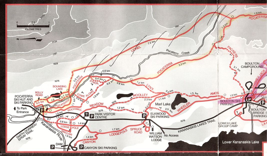
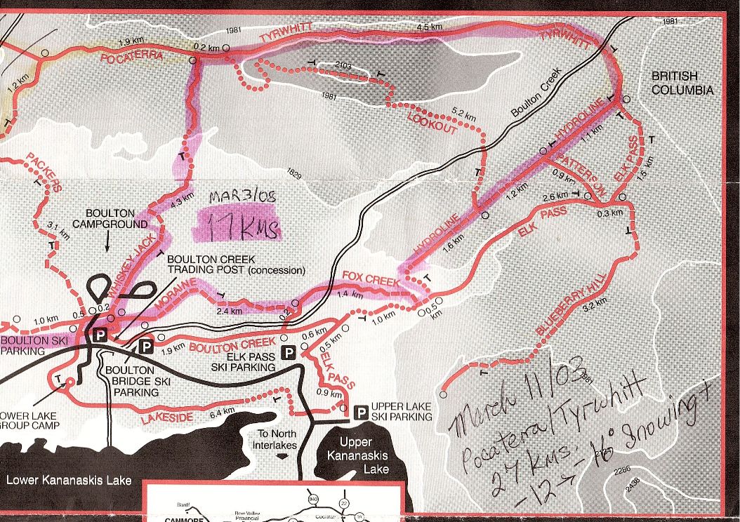
Meanwhile, courtesy of Helen Read, here is a Peter Lougheed Provincial Park trail map from 1986. Grooming on many of these trails was discontinued before I started skiing. If I could have one of these trails back, I’d pick Lakeside. It would connect the two spurs which now are dead-ends, Lower Lake and Upper Lake to Elk pass. Does anyone know why grooming was discontinued on Lakeside?
PLPP North trails from 1986
Click on the map for a larger image.
PLPP South Trails from 1986


Several seniors clubs have been using these abandoned ski trails along with powerlines, campground roads, and creek valleys as snowshoe routes for the past 6 or 7 years. The old lakeside ski trail is especially useful when we start or end at the Elk Pass parking lot. I wish they would discontinue Sinclair as this would give snowshoers good access to everything west ofthe powerline from pocaterra hut to the upper lake and Elk pass parking lot without touching existing ski trails.
The “Lionel” trail is Hwy #40.
The trails that are no longer being groomed at PLPP, as well as the Sawmill network in the Smith-Dorrien valley are no longer being groomed because Alberta does not have enough money to groom endless kilometres if XC trails…and apparently XC skiers don’t want to pay to have trails groomed.
Thanks, Alf !
This is interesting, I love old maps. I’m really wondering about how the Lionel trail would fit into the network in regards to the topography now that Pocaterra has changed so much.
You can possibly still see the remnants of the Lakeshore trail on Google Maps: http://goo.gl/maps/Y2tqP
The Lionel trail looks like it was close to the highway.
https://picasaweb.google.com/lh/photo/4zbgqkuwpUNm1GDETy5cmdMTjNZETYmyPJy0liipFm0?feat=directlink