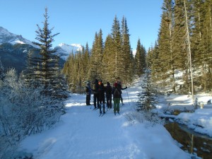
-Skiers getting ready at the Goat creek trailhead-
Another great ski on Goat Creek again today. I could ski it over and over because you never know when you’ll get another opportunity to do it with conditions this good.
I was dropped off at the trailhead above Canmore at 11:14 a.m. and had to be in Banff by 1 pm. Would I make it? I usually take around 120 -150 photos on a ski trip but I’ll have to cut that in half today.
The air temperature was -14°C but with no wind and sunny skies, it didn’t seem very cold. The snow was -16, so easy waxing with VR30(-10/-30). My concession to the cold weather was an extra layer up and down, heavy gloves and toe warmers.
A large group of skiers started about two minutes ahead of me. I could see them standing at the bottom of the first downhill so I decided I better just walk down because I didn’t know if I’d be able to part the red sea. One of them was struggling to get down the hill.
Goat creek is not a trail for beginner or novice skiers. I’m not a beginner yet some of the downhills still scare the %#* out of me.
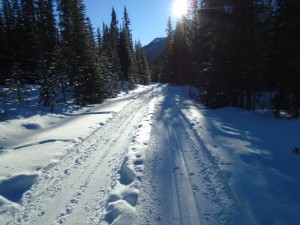
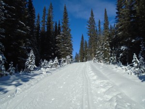
I skied on the “wrong” side of the trail for the first 4K because the tracks were in better shape on that side, and they were quite fast for being so cold.
The steep downhill to the Goat Creek bridge is still in good shape but it was well-scraped by snowplowers and will be sketchy by the weekend if we don’t get any snow.
After crossing the Goat Creek bridge at 7K the trail has more uphills so I wasted some time by removing all the extra clothing I was wearing. 41 minutes has gone by and I’ve only got 65 minutes to get to Banff.
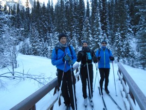
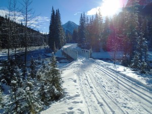
After another 2K, the Spray river bridge was where I met Pat, Jill and Bruce. They had skied from Banff and said it was -16 at the start. The Spray river bridge was their destination for the day which is 9.9K from Banff.
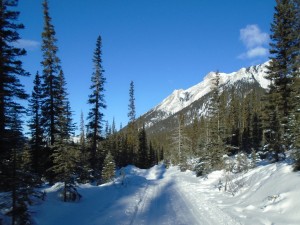
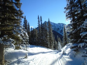
The trail for the next 3K is one of my favourite places in the world. I think there were even more wolf tracks than two days ago, and lots of scat. With the sun shining brightly on the mountains and snow-laden trees along the trail, I probably stopped and used up more time taking photos than was allotted to me.
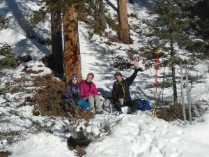
At the Spray east-west junction I decided to take the east side as I only had 25 minutes left, and it would be faster. First, though, I had to stop and take a photo of the three skiers sitting in the sun having lunch. They yelled out, “Hello from Germany.”
Spray river east is quite flat compared to the west side and I was able to double-pole most of the way. I hit the golf course at the Banff Springs hotel at 1:01 pm. My ride was waiting and I high-tailed it to Tunnel Mountain which you can read about in my previous posting.
We didn’t get the snow in the mountains which West Bragg and Calgary received, but I see that TSJ has groomed the Bill Milne, Wedge pond, and some Ribbon creek trails.
This winter we are getting regular updates from West Bragg Creek and I bet everyone appreciates it. If you ski at West Bragg, consider making a donation.
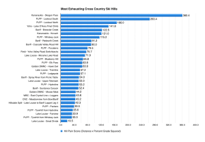
Risto, one of the regulars on here, has prepared some neat graphs which will help you decide if a trail is suitable for you Risto’s Hill Pain Score. It’s similar to Ray’s Trail Steepness with a bit of a different angle. They both can be accessed under the Resources tab on the main menu.

There’s also a killer hill coming up from the Spray River towards Watridge trail at Mount Shark. It looks (and feels every bit) like the 1.1km @8.2% calculated by my Garmin.
And the steepest 500m stretch is 11%, with an absolute max of over 20%!
My GPS showed an 80 metre gain over 740 m distance. = 11%
Hi,
I haven’t skied that one myself, but I used an online GPS visualizer to estimate 500m@12.2%, 1.0km@8.4%, 1.5km@6.7%
I also found it on Strava, but there the steepest section was only 9.8%
Seems there’s quite a bit of variability in GPS data.
I should get one with a barometric altimeter
Hi Risto, don’t get me started on Strava and Nordic skiing! How did you find it on there?
Nice chart. Tells the story very well.
Thanks Also, don’t miss the other charts that list the steepest 500m or 1km sections of various trails under http://skierbob.ca/ristos-hill-pain-score/
Great charts by Ray and Risto.
But to begin on a serious note, I imagine that an equivalent downhill rating is much more difficult to come up with, for many reasons.
Why would one desire a downhill rating?
Well, for one thing, I can certainly envision two equally fit skiers, both with good uphill technique and both able to climb to the tops of these big hills, but with one having much better downhill technique than the other. So, while one schusses the downhill, the other leaves sitz marks.
But complicating things is that not all downhills are made alike. I read the reports of the Skogan Screamer, wondering how I would fare. I love these trip reports!
So, while each uphill can have an aerobic rating of some sort, the downhill is a different beast – steep hills, sharp turns, ridges of snow, narrow sections etc.
Then one could also think of having a ‘utopian’ downhill rating. This would describe those downhill runs that you wish would never end, as opposed to surviving with all limbs intact. Bob and his fellow trip reporters describe these runs in passionate terms from time to time. Like an effortless, flushed 6 iron, it makes the skier come back over and over again. Pocaterra and Fox Creek come to mind.
I enjoy the fun that all of Bob’s army is having on the trails this year, be they steep or not, and forgive my personal downhill rating system example given below (but it’s true – shhh !).
Merry Christmas and wishing blue wax skiing to you all .
https://picasaweb.google.com/lh/photo/yiVbS9_oM7-V4Xzkw2eqXNMTjNZETYmyPJy0liipFm0?feat=directlink
I can think of a few more to add to Risto’s list:
Ribbon Creek-Coal Mine
Ribbon Creek-Sunburst
Ribbon Creek-new Ribbon Creek (going east from Kovach Link)
I haven’t skied much in the Ribbon Creek area. Will have to go there this weekend