
– Eating lunch among the clouds on Grassi knob –
With apologies to Joni Mitchell, this is one hike which will stand out as one of the most memorable for me. It wasn’t the highest, or longest, or most dangerous. It was, however, a sensory delight with Goldilocks weather, a different birdsong at each elevation, wild flowers, and a spectacular, panoramic view.
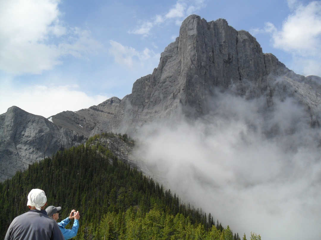
Ship’s prow as observed from Grassi knob
Best of all were the clouds. Feathery clouds which floated like apparitions before our very eyes, then quickly drifted off to the east where they would caress the peaks and valleys of the sisters.
Everything is more fun when you’re in the presence of good company, too. As Chip, Peter, Ray, Mary, Doug and I set out from the east connector of the Highline trail, the weather didn’t look too promising, and within 10 minutes it was sprinkling. I suggested to Mary that she put on her rainwear, and sure enough, the ploy worked and the precipitation stopped.
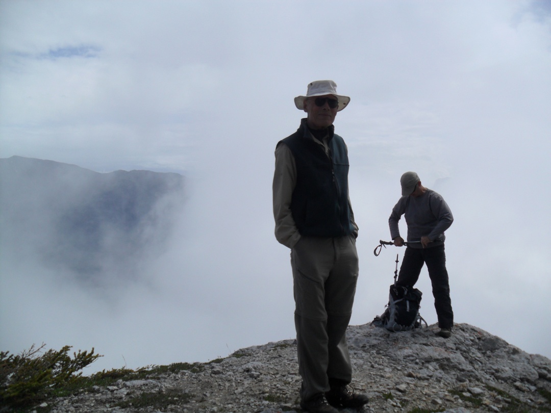
Ray and Doug on the summit of Grassi knob
Twenty-five minutes into the hike, as we were making our way up the Ship’s prow creek canyon, we were enjoying mostly sunny skies. Engrossed in conversation, I missed the flagging which indicated our trail going up to Grassi knob, our ultimate destination for the day. When I finally realized I was in uncharted territory, I called to the group to turn back and go the correct way, adding 100 metres of distance to our journey.

The summit of Grassi knob, under the watchful gaze of the three sisters
Grassi knob is easily observable from the highway as you drive through Canmore. It sits in the shadow of the taller, steeper Ship’s prow, part of the Mount Lawrence Grassi massif.
It can be hiked as a traverse if you arrange a car shuttle, which we did, ending at the eastern end of the Highline trail at Hubman Landing. It’s 8.8K with 770 metres net elevation(917 m of accumulated elevation). If there is a lot of water flowing in Ship’s prow creek, it would be very difficult to hike the north approach, as you are in and out of the creek on some very slippery rock slabs.

Looking towards Canmore from the summit of Grassi knob
The trail starts at the east end of the Peaks of Grassi in Canmore and proceeds up the Highline east connector. At 1.6K you’ll cross the Ship’s prow creek. After crossing the creek, take 10 paces and look to your right. On the steep, grassy bank you’ll see a vague trail heading up with deadfall across it.
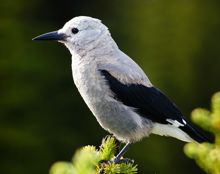
We observed and heard a Clark’s nutcracker about half way up
It would be too long-winded to try and describe the adventure which awaits you in the creek bed, but if you can find your way, there will be pink flagging at the point where you leave the creek and head up a well-defined trail for the remainder of the way. From the time you leave the Highline trail until you reach the flagging, it’s only about 200 metres in distance.

3 dudes and 3 sisters
With birder Chip along, we were able to put names to the various birdsongs which we heard on this hike. We even spotted a few of them, with the Clark’s Nutcracker being one I was able to actually see. We also listened to delightful songs from Townsend’s warbler, Swainson’s thrush, white-crowned sparrows, and chipping sparrows.
From a hike last year, I’ve written in more detail about the Grassi knob north approach
I’ve also written a couple posts when taking the eastern approach, but there is a shorter way which you can read about in a blog post from Bob Spirko, and this is now the route that I take. He has a downloadable GPS track, which can be followed quite well, but I found that it doesn’t work for the part where you’re in the creek bed.
no images were found
I found this reference. Would this describe part of Peter’s route?
http://www.clubtread.com/sforum/topic.asp?TOPIC_ID=51745
That’s the same route we took Henry except we went to Canmore wall summit instead of Mount Lawrence Grassi summit. We started by parking at the peaks of Grassi trailhead at 800 Wilson way and accessed the highline trail from there.
Sounds like fun !
Magical clouds Bob.
Hi Bob! We missed the flagging on Ships prow creek like you did. Instead of turning back we just kept following the creek all the way to the top of “Canmore wall”. It’s the large cliff between Grassi knob and Ha Ling peak. The lower sections of the creek had a few more difficult scrambly bits (on descent we scurted around these in the trees above the creek) but once in the upper valley it was easy cruising! The scenery and waterfalls below the Ship prow cliffs were very impressive! Once you get to the back end of the valley you just pick a scree slope to zig zag up which will get you to a ridge attached to Mount Lawrence Grassi summit. Turn right and head along the ridge to a cairn at the summit of Canmore wall. There was a damaged (vitamin bottle!) register with a single name in it and an elevation of 2536m mentioned. Overall an excellent trip! Even though we didn’t get up Grassi knob we ended up much higher and with even better views! I would highly recommend it if you get the chance!
I’ll try it one of these days, thanks! -Bob