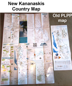
I became aware yesterday that you can no longer obtain a dedicated ski trails map for Peter Lougheed Provincial Park(PLPP).
 The new map, entitled Explore, covers all five areas in Kananaskis and is very large when it’s unfolded. It shows the changes to the trails which were caused by the 2013 floods.
You can still access the more compact PLPP ski trails map online and print it. It doesn’t indicate the changes to the trails caused by the floods.
I’ve also scanned it and put it on my main menu under Maps.
******
Canmore Nordic Centre
Please note the following closures for the Haywood NorAm/Western Canadian Championships, January 15-18th, 2015 at the Canmore Nordic Centre:
The cross country stadium and cross country competition trails will be closed to the public from 9am-3pm from Thursday to Sunday this week. During this time, you will need to access and return from Meadowview and Rundle via the Mine Meadow. Expect parking congestion, especially on the weekend.
Brewster creek
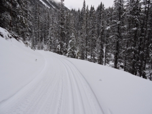
I didn’t know that Brewster creek was being groomed by Mike until Chuck mentioned it today. You won’t find this information on the Banff trail report. Last night when I saw Chuck’s photos of Brewster creek, I was wondering how it could still be in such great condition when it hadn’t been groomed since Dec 30 according to the Banff trail report.
Loppet season is here
I have a Loppet page which lists some of the fun races which Calgarians, Banffites and Can-morons like to participate in. Nipika is reporting excellent snow conditions and their loppets occur on Jan 31, and Feb 1. Register for Nipika on Zone 4.


There are a couple of good things about the new K-Country ski trails map in the larger format. It is a good cross-promotion tool for people who are only really familiar with one of the XC trail networks. Perhaps it will inspire skiers to try a variety of trail systems throughout the winter.
The design of the “EXPLORE” Kananaskis Map is such that you can simply cut the big map into smaller individual area maps. That way, you can have a compact map for each specific area.
I’m probably biased, but I prefer the format for the West Bragg Creek trails, which shows both XC and snowshoe trails on the same map… as opposed to having separate and unconnected maps for snowshoeing and XC skiing at PLPP.
Where is Brewster creek trailhead and is that a dog friendly trail?
Thanks for the fabulous blog, Bob.
It’s dog-friendly as are the two trails you are required to ski on to access Brewster creek. The trailhead is at the Cave and Basin in Banff. Unfortunately, with the Healy creek bridge still out, this is the only way to access it.
It starts with a 500-metre hike in your ski boots. Park at the Cave and Basin and walk up the hill past the Cave and Basin and you’ll eventually come to the wide trackset trail known as Sundance Canyon. You’ll recognize it by all the people walking in the tracks. After 2.4 kilometres you’ll come to the Healy creek trail. After 2.9K on Healy creek, you’ll arrive at the Brewster creek junction.
Accessing Brewster creek used to be a short 1.8K ski from the Healy creek trailhead. It will be again some day.
If you’re not already too discouraged, check this blog post from last year: http://skierbob.ca/2014/02/family-day-in-banff/
I bet your dog would enjoy being on Sundance and Healy if it’s too far to Brewster creek.
You might also want to reference this page http://skierbob.ca/dog-friendly-ski-trails/