
I met lots of happy skiers today, took lots of photos, and tried to remember many names and I’m not sure if I got them all correct, so if you see your picture here with the wrong name send me an email and I’ll correct it. (You can click on any photo to see a larger image.)

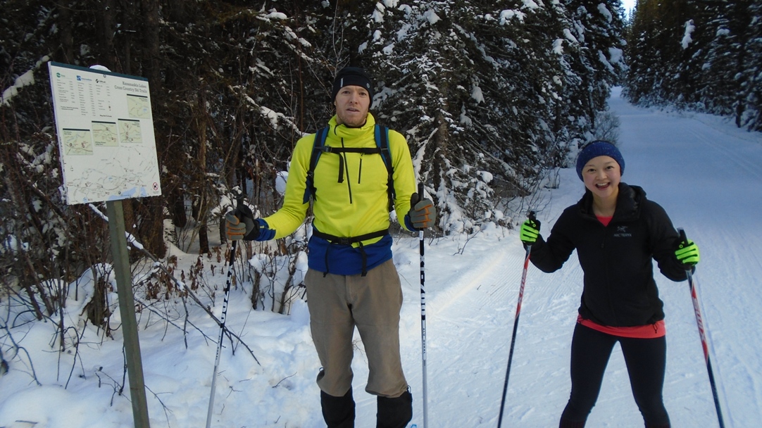
Jason and Jen on Whiskey jack. You could create an attractive Christmas card from this scene.
What incredible conditions today in PLPP on the new tracksetting. We had a brief scare this week with warm weather, wind and tree debris but all is forgiven.
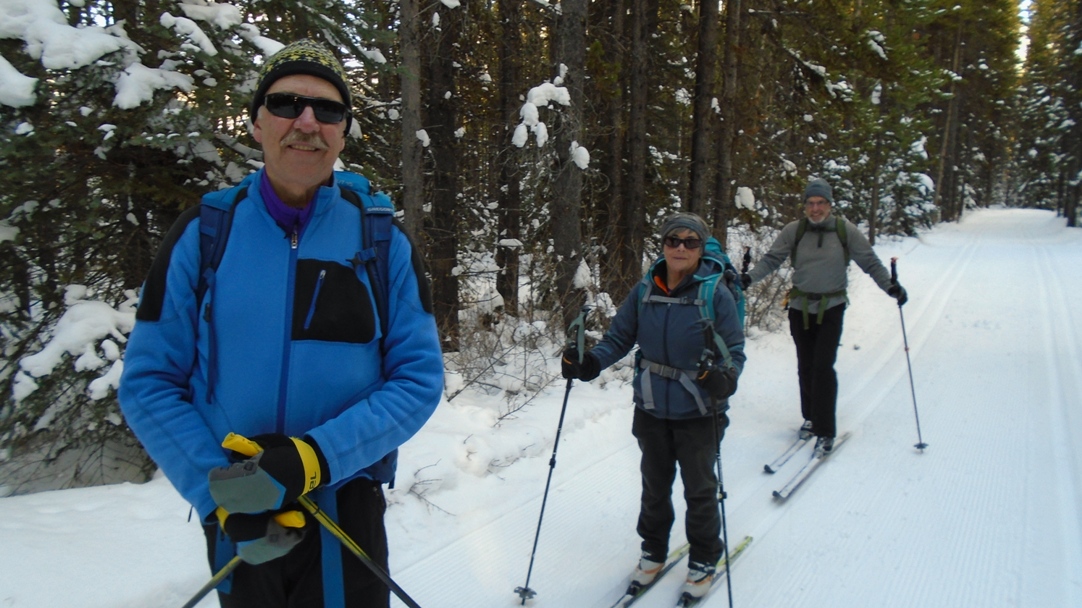
Ron, Nancy and Bernie from the Ramblers on Whiskey Jack
Again this morning I was debating where to ski. The Pipestone trails have been on my agenda and I see from the Trip Reports that I could have had an enjoyable ski there, too, but it’s hard to resist freshly groomed trails in PLPP and when I saw the Live Grooming Report the matter was settled.

Pocaterra near the Whiskey jack junction
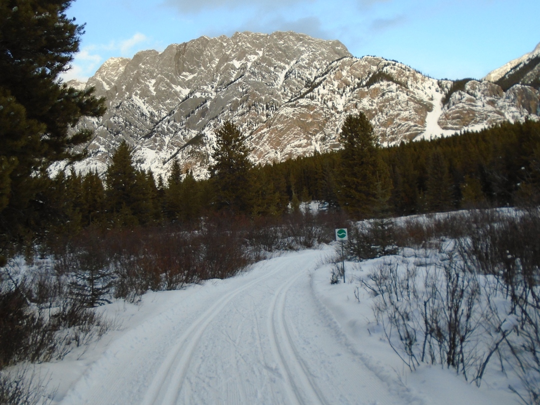
Driving out to Kananaskis could discourage a skier. The ground is mostly bare from Canmore to Barrier lake(probably more so from Calgary) and the wind was blowing. There was a light breeze in the Boulton creek parking lot, but once on the trail, you’re in a different world. It’s cold but not bone-chilling, you’re sheltered from wind by the snow-laden forest, and the snow-capped mountains glisten in the sun.
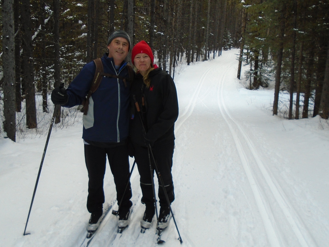
Brennan and Christine at the Pocaterra – Packers junction
The air temperature was -1°C at 2:20 pm and the snow was -4. I waxed with VR45(-2/-8) and had good grip. The tracks were well-polished and quick; my average speed today was lightning-fast at 10.4 KmH(for me, anyway).
When I was at the Pocaterra – Lynx junction yesterday I could not see any trace of Mt Wintour due to the heavily falling snow
From Boulton parking to the top of Whiskey jack it’s 3.8K of up, up, up. As you climb, you hear screams of both delight and terror wafting through the winter air as skiers descend the steep snake of a trail which drops 200 metres. The runout zone has been well-used by skiers with too much speed at the 90° corner.
Craig and Patti on Lynx
The fast run down Pocaterra to the Lynx junction was like flying without wings. A few pine needles along this stretch were the only blemish on an otherwise perfect day of skiing.
At the Lynx junction I skied a short distance on the ungroomed portion of Pocaterra to see just how much snow accumulated. Remember, I was here yesterday on my waxless skis going painfully slow through the fresh, moist snow. There was about 6-8 cm of new snow on the trail today.

At the bottom of this hill you’ll arrive at the Lynx – Amos junction
Lynx was the only trail I skied today which didn’t have overnight tracksetting. Like Pocaterra, it sported 6-8 cm of new snow but the tracks were still reasonably good. Rather than take the shortcut on south Amos back to Boulton, I decided to extend the merriment and revelry by taking the roundabout on north Amos and Wheeler.
I don’t know if there will be any more tracksetting before tomorrow, but you can’t go wrong even if you are on the trails with the fresh snow.


Thank you for your comment, Rosemary. Sorry, I do not have a .gpx. It is on my list of tihgns to do. As you cross the dam the penstock is clear and the route is obvious. You need to park in the Canyon area off Kananaskis Lakes Road and cross the dam on the route which goes by the washrooms and across the spillway. The route in from parking at the Peter Lougheed Visitor Centre would add about 3 KM to the snowshoe. On the other side of the dam (northwest), hang a right and follow the road in the reverse direction along the bottom of the dam. At the junction where a sign has two arrows for the Penstock Loop Trail, keep right and head to the Penstock. If there were any signs preventing admission, I ignored them. It is a construction zone and there are warning signs but caution and common sense worked well for me. I did not, and would not, climb the wooden steps over the penstock to the other side. An apron along the length of the penstock provides clear view. There is an exit to road at the far end of where you can practically proceed. You could return the way you came as well. Any number of options. Have a great snowshoe. I hope the conditions are ideal for you and your group. Stay safe.