
A couple days ago I had a very enjoyable bike ride on the first 8.9K of the High Rockies trail. To access the trail, you first have to travel for 900 metres on the Goat creek trail, starting of course at the Goat Creek parking lot. All my distances on this report will include the 900 metres.
This trail is destined to be 80 kilometres in length on completion, so before I get started, check out the excellent overview of the trail from Tony Daffern on the Kananaskis Trails blog.
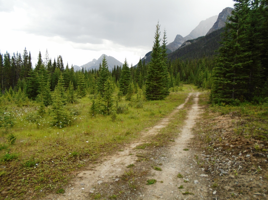
Spectacular views along the High Rockies trail
I started in mid-afternoon when the weather is prone to thunder showers, and I was accompanied by some pretty loud thunder for most of the trip out. At 5K, the trail was wet, so the rain was moving ahead of me.
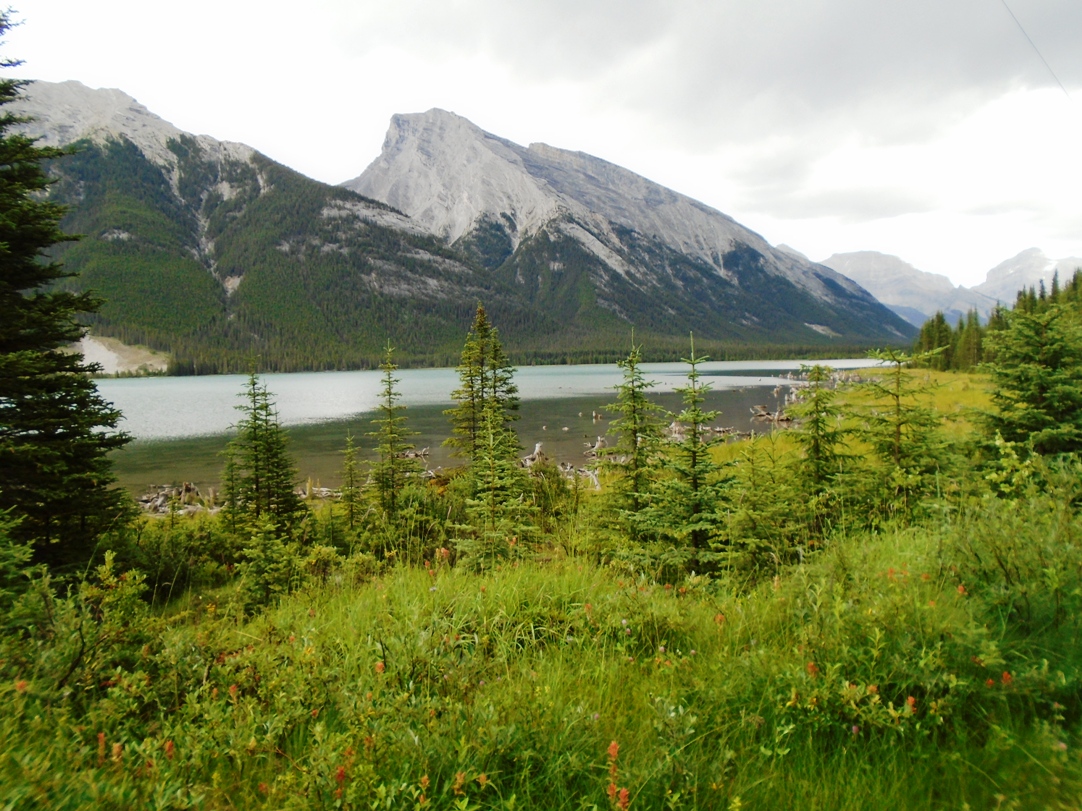
Passing by Goat Pond on the High Rockies trail
The High Rockies trail, at least the portion which I rode, was quite easy and that’s just the way I like it. Goat creek parking lot elevation is 1680 metres. The elevation dropped to 1637 metres soon after starting out, and the highest point on my trip was 1722 metres near the 5K mark. I only had to use granny gear once, and that was right near the end on the return as I was climbing back up to Goat Creek.
The trail is not enclosed in trees, so there are spectacular views for most of the way. You reach Goat Pond at the 7K mark, and get occasional glimpses of it for the next kilometre.
The portion of the trail I rode is situated well away from the Spray Lakes road, so you’re not bothered much by road traffic.
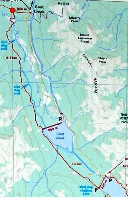
The portion of the High Rockies trail covered in this report. Map courtesy of Tony Daffern
At 8.7K you’ll encounter a swampy section which has a 200-metre boardwalk, and it was at the end of the boardwalk when I had to turn around. Workers with large machinery were busy on the trail, it looked to me like they were expanding the boardwalk. You can go a lot further, but I didn’t want to disrupt the workers. The group of bikers who I met earlier had gone as far as Driftwood at 14K.
It was probably fortuitous that I turned around there because it started raining and appeared to be raining hard in the southerly direction. As I headed back north, I was soon out of the rain and into blue skies.
I was impressed with all the flood mitigation features which have been constructed along the trail. Numerous drainage ditches should help prevent wash-outs. On the other hand, don’t hit them at high speed as some of them are quite deep and the walls are steep.
This would not be a challenging trail for die-hard mountain bikers.


Would you consider it for fit(ish) kids? Like 5 and 8 year olds?
I think the kids would do okay. -Bob