
This section of trail is 12.2K and while it has a lot of variety and various levels of difficulty, the best part is that you can finally access the High Rockies trail from a paved road! I rode all the way to Chester, which is a further 7.4K but I’ll write about that at a later date.

High Rockies Peninsula trailhead at Kent Creek. The blue sign ahead on the road is for the Peninsula day use area.
The best resource for detailed descriptions of all sections of the High Rockies trail, along with detailed maps is Tony Daffern’s Kananaskis Trails blog.
After reading Michael and Annalee’s trip report, I decided to check out this newest section of trail which is 99% completed but not officially open. There are no trail markers, and the finishing touches are still still being completed on the impressive suspension bridge overlooking a deep and spectacular canyon.

High Rockies trail
With no signage, I’m not sure if the starting point should be referred to as Peninsula, or Kent Creek. The trailhead is where Kent Creek crosses the road. I’ll update this post as new information becomes available.
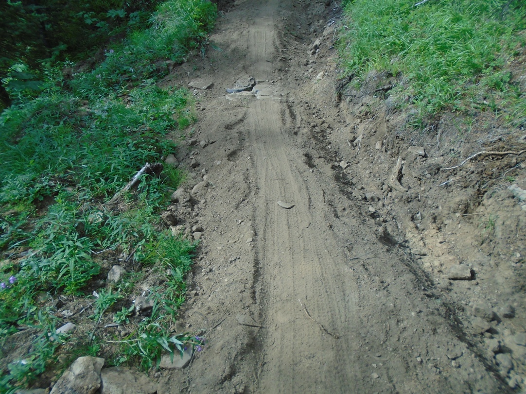
Some parts of the trail were very narrow and powdery soft
Peninsula to Sawmill
I found this 12.2K section to be quite enjoyable. There’s a steep hill at each end, but once you’re on the ridge, the riding is pleasant with small ups and downs as the trail twists and turns through the trees. At 3.8K you’ll cross the suspension bridge. The bridge sways, so I dismounted and walked my bike across.
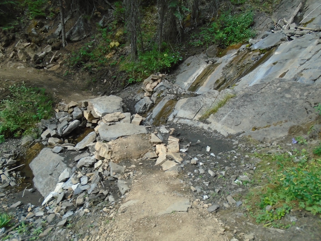
There are some interesting features along the trail including this creek crossing
This trail is mostly in the trees, but you get occasional glimpses of the mountains. There are numerous creek crossings, and one in particular is quite spectacular. This is from Tony Daffern’s Kananaskis Trails blog:
“On trail make a long climb to a deeply incised creek. In fact from the bridge the downstream view is positively vertigo-inducing. The trail designer’s excitement at having discovered such an incredible crossing place explains why the trail is uphill in both directions.”
There’s a net elevation gain of 140 metres to Sawmill, but with all the undulations, my GPS indicated a total ascent of 300 metres. The high point is 230 metres net gain. Ideally, the best way to do this section would be to get dropped off at Sawmill and ride one way to Peninsula, enjoying more downhill.
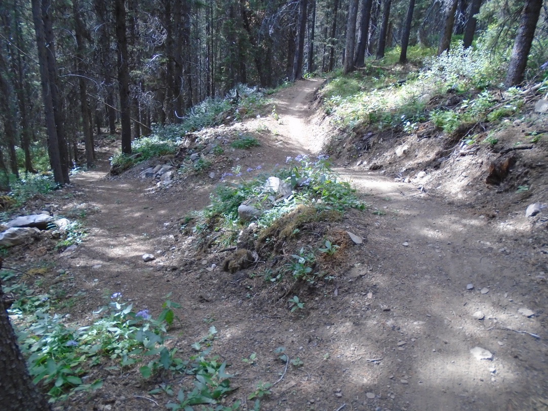
A fork in the road. The trail to the left is the access from Black Prince.
The Peninsula(aka Kent Creek) trailhead is not easy to find. I drove right past it initially. As skiers, we’re all familiar with Pocaterra Hut, so if approaching from Hwy #40, turn onto the Smith-Dorrien at the hut and go 3K. The inconspicuous trailhead is at Kent creek on the right-hand side. You can’t see any sign of a creek from the road. The road is paved for 3.2K up to the Peninsula day use area. If you reach the Peninsula day use area, you’ve gone 200 metres too far.
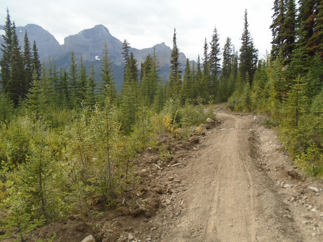
Getting near Sawmill
There is some parking available at the trailhead, but if it was a busy day, you’d probably have to park at Peninsula and backtrack for 200 metres to the trailhead.
At 3.8K, and an elevation gain of 160 metres, you’ll encounter the impressive suspension bridge which spans the deep gully of Blackshale creek. There is a newly constructed access trail from the Smith-Dorrien up to the suspension bridge which starts at the point where Blackshale creek crosses the road.
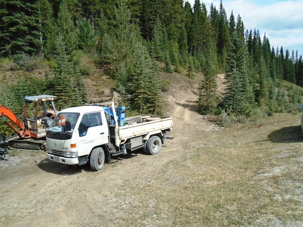
Blackshale creek access point. The trail in the photo is for the workers who are constructing the suspension bridge.
This access trail to the suspension bridge is about 500 metres in length with an elevation of 60 metres. You can easily spot the access trail when driving up the Smith-Dorrien. It’s exactly 3K from the Peninsula day use turn-off.
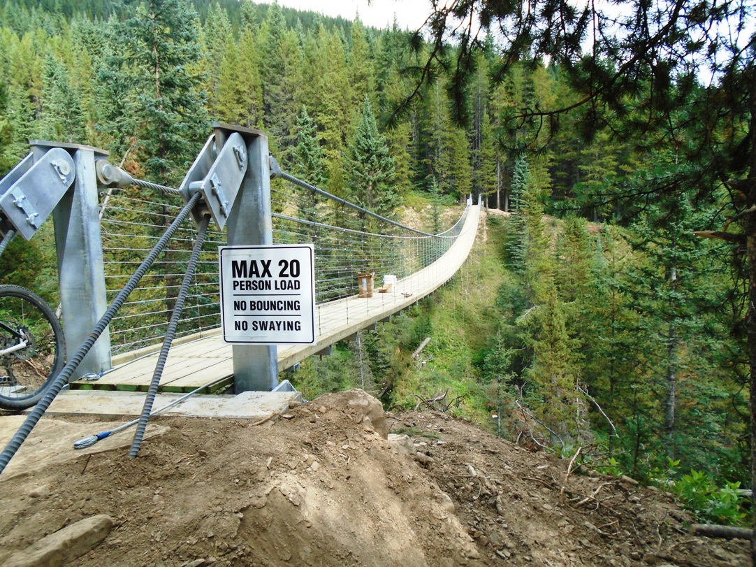
The suspension bridge over Blackshale creek
There is also another access trail from the Black Prince parking lot. As previously mentioned, there is no signage on any of these trails yet.
Some of the newly constructed sections of the trail are very narrow and powdery soft. I had to walk my bike a few times when it was simply too difficult to stay on the 10-inch-wide tread. You would not want to be here on a rainy day.
When you’re about 1K from Sawmill, the trail starts to descend, some of it steeply and other parts gradually. Parts of it follow the old ski trails and these are wider and very pleasant.
Previous High Rockies reports:
Part 1, The first 9K of the High Rockies
Part 2, Goat Pond to Spurling Creek.
High Rockies; Back to the Beginning


Hi Bob,
Thanks for your post. It helped us to find the Peninsula Trailhead. Today (Sep 2nd), my wife (Sue) & I rode the Peninsula to Sawmill segment of the HRT and really enjoyed it.
Perhaps this link showing our ride mapped might be helpful to others: https://connect.garmin.com/modern/activity/1954637174
Feel free to share it.
cheers,
Tom O
Hi guys!
Is it really only 3 km from Peninsula to the suspension bridge? It felt a lot further, and the map seems to show that it is, too.
Thanks,
Diana
Gosh, already missed you again Diana!!! My girlfriend and I parked at Sawmill yesterday and hiked the High Rockies Trail east out to Peninsula/Kent Creek exit point. We got a hitch back from a lovely N.S. couple who were camping at the Spray. Sawmill to Black Prince is 6.2 kms; Black Prince to Suspension bridge is 2.3 kms; and Suspension Bridge to Canyon is 5.2 kms but we exited on pavement across from Peninsula. One can avoid the bridge and walk down to the road on either side of it, but it is a magnificent 70 metre long work of art!!!!! These distances are off High Rockies maps. Pic is one of the “Bridge Engineers!” who was putting on finishing touches yesterday.
Helen!! 😀
Oh well, I guess I can read, after all — I checked out Tony Daffern’s trail description, and it looks like 3.8 km from the road, so 4 km from Peninsula.
Yes, the bridge is beautiful! It was closed when we arrived, and I had a nice chat with the young man working on it.
Diana, I have to admit the 3K was a guess because I didn’t have my GPS turned on. I’m glad you provided the correct distance from Kent Creek to the suspension bridge(3.8K). I’ve updated the distances in my post.
I received this email from Steven Kostamo, the man in charge of building the suspension bridge:
I read your review of the trail and bridge. Your comments about the bridge swaying may need to be revised. Tomorrow I will be completing the anti sway/wind brace cables that connect to each side of the bridge. It will bounce a bit but a lot of cyclists have ridden across. I noticed the bridge bounces less when they ride in comparison to walking.
Fyi the trailer and excavator is gone as of this morning.
Hi Bob. We visited the suspension bridge yesterday morning. An impressive structure. We have had a guide to the High Rockies Trail on our website for about 2 years, updating it as construction occurred. My task for this moring. There are three maps showing the line of the trail and connections to it and a complete GPS track log. The direct URL is http://kananaskistrails.com/high-rockies-trail/index.html. here is also a link on our home page.
Thanks, Tony. I’ve added a link near the top of this post that will take people to your blog which is the best resource, by far, for maps and detailed descriptions of all sections of the trail. -Bob