
Feb 22, 2021: All the photos I’m posting in this update are historical photos.
For those of us who stick to groomed ski trails, the avalanche danger is minimal although there are a few trails where it could happen.
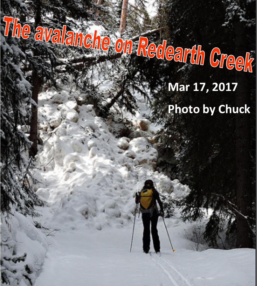
 Redearth Creek at 3.7K and 4.7K. Also, Normand made this observation… “based on ancestral slide paths off Copper Mountain, the section of the ski trail from km 8.2 and 8.7 is the most obvious. When the ski trail gets very close to the creek, past the Lost Horse Creek campground, you are entering that 500 meters section. The ancient pamphlet Nordic Trails in Banff National Park confirms Normand’s observation.
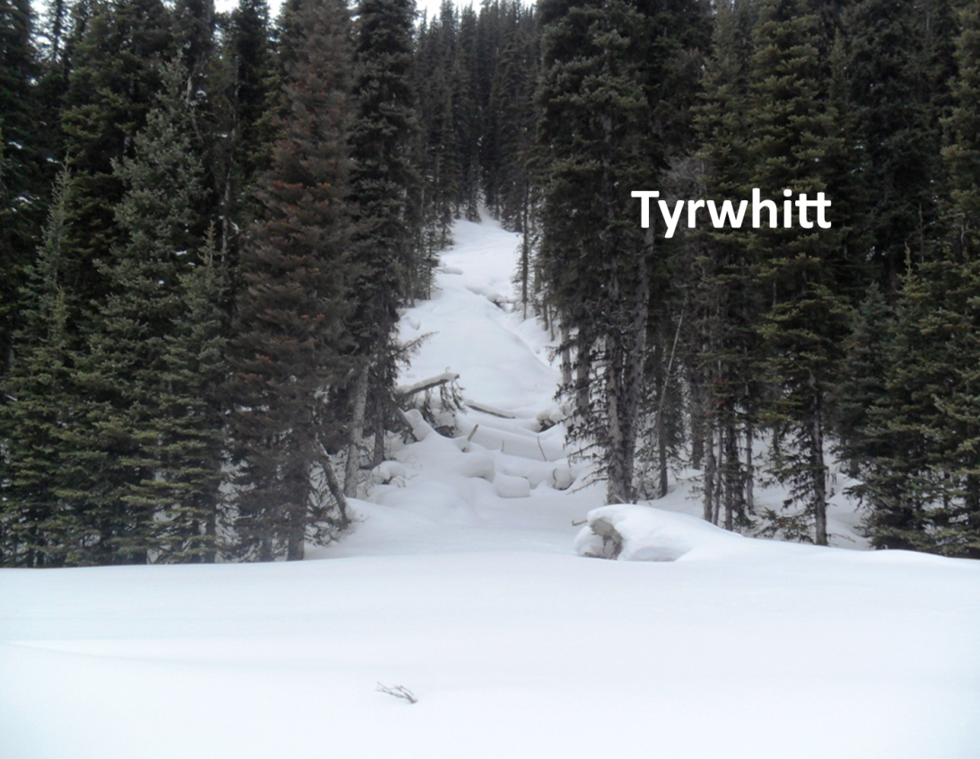
 Tyrwhitt experienced an avalanche in April 2012. The zone is approximately 200 metres past the high point if traveling south which is right at the beginning of the meadows. The avalanche path is very narrow, around 20-30 metres.
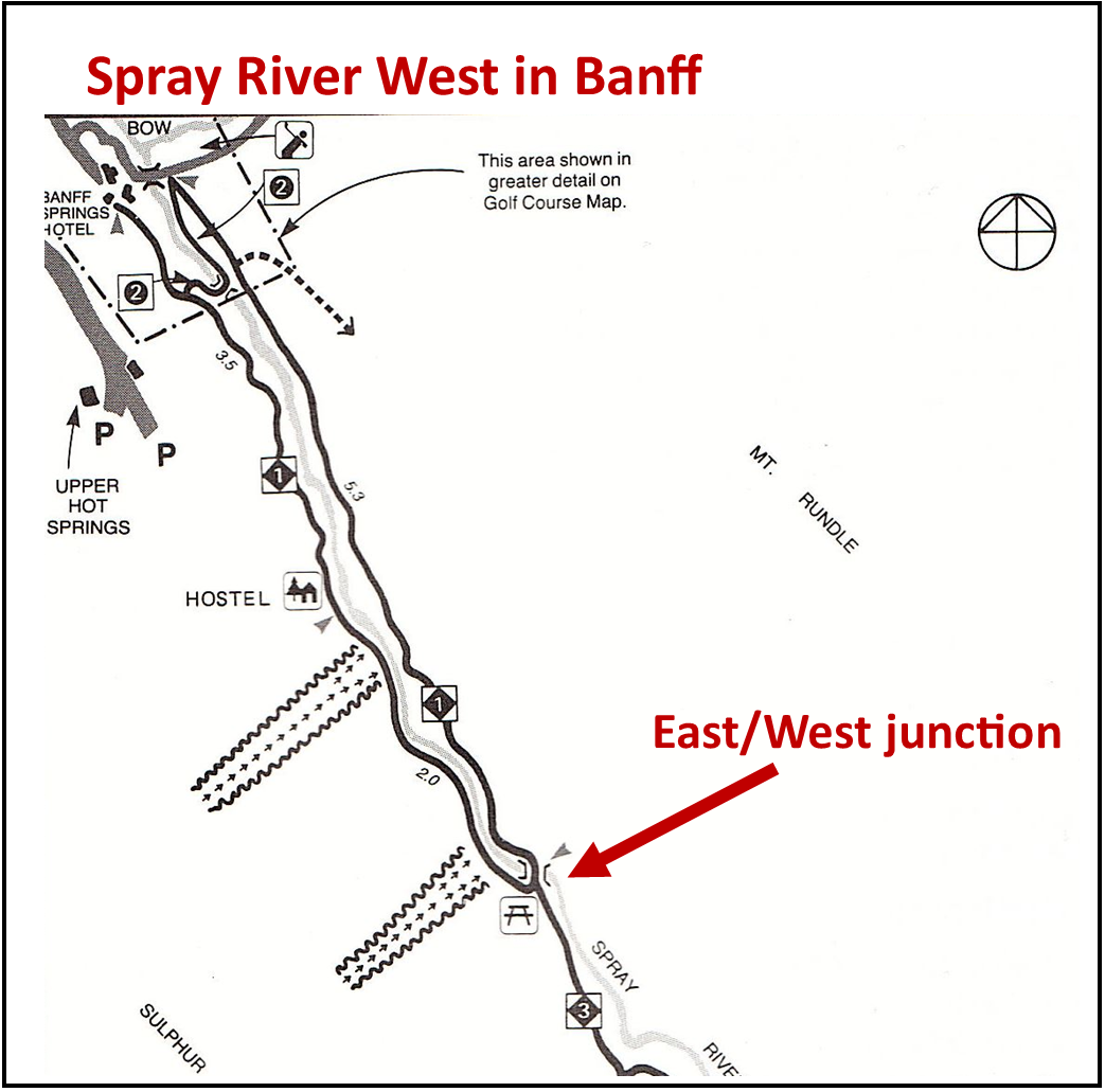
Spray River West. I’m attaching a map which shows the locations. There are two of them. Approximately 3.7K and 5.2K from the trailhead. Both are before you reach the East-West junction, better known as the Bus Stop junction.
 Elk Pass has been closed a couple times in recent years to assess avalanche danger. The location is approximately 2.2K from the trailhead, just past the first Hydroline junction. I don’t recall any avalanche happening during my tenure.
Moraine Lake road beyond the tracksetting. At 9K there is a warning sign.

No avalanche, but Elk Pass is occasionally closed to assess avalanche risk.
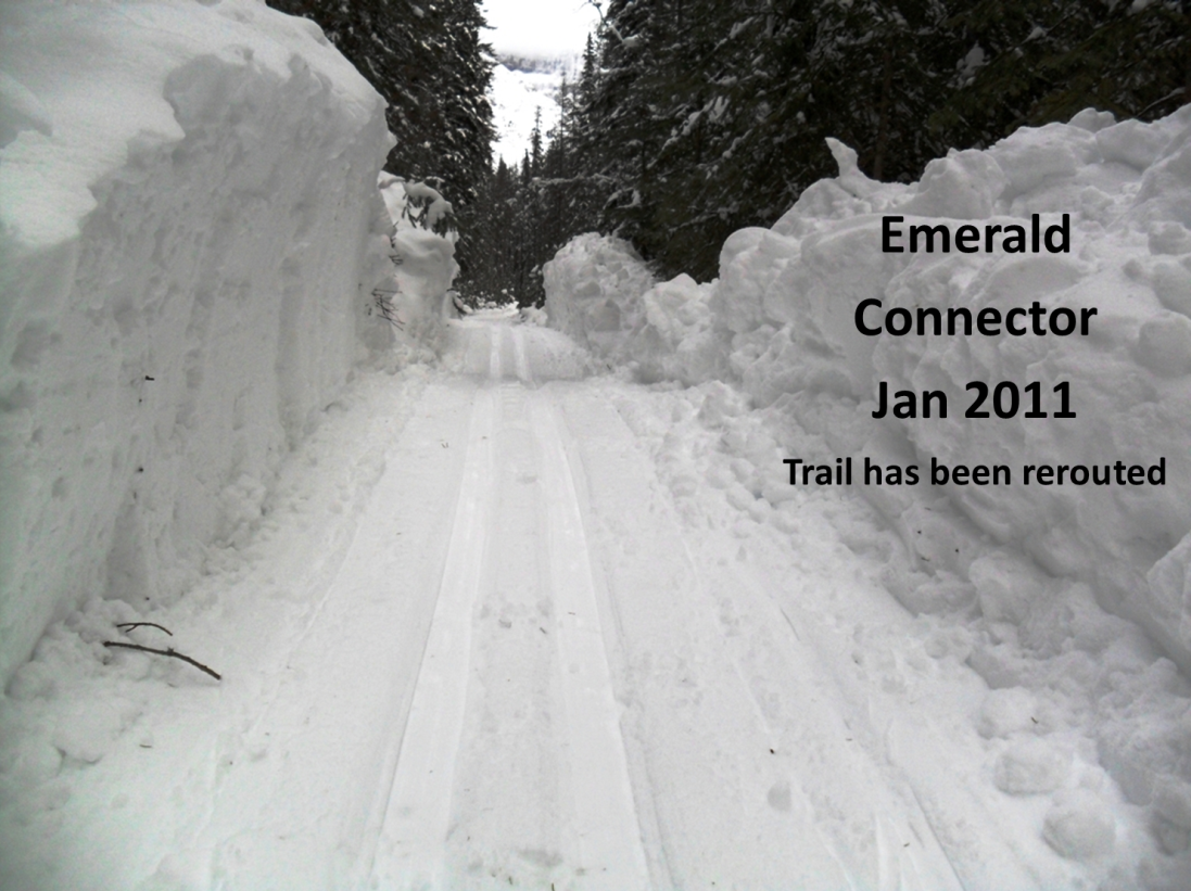
Yoho/Emerald Lake. One section of the Emerald Connector has been rerouted after the 2011 avalanche. There is still a section on the Connector with risk and you’ll see the sign when skiing there. The Horse trail has been rerouted due to avalanches in recent years. That’s why you now have to ski on the lake for a short distance to access the horse trail and the alluvial fan.
Present day sign on the Emerald Connector
Lake O’Hara Fire Road. An avalanche occurred in 2017 at 6.5K from the trailhead. This trail is only groomed if the lodge is open which usually happens in Feb and March.
Boom Lake is not a groomed trail, but it sees a lot of traffic. See previous post for details of Sunday’s avalanche. One individual ended up in the lake and another was partially buried. The trail crosses several avalanche zones as you approach the lake, and also on the lake itself.

Boom Lake, Mar 2019. Photo by Chuck
Regarding Boom Lake, Chuck remarked, “To be clear, the avalanche path in question is not off the headwall at the end of the lake, but rather about half way along the lake at the base of a huge avalanche path, as seen in pictures number 5 & 6 in this photo link from March 2019:
https://1drv.ms/a/s!AgTx5EOCG7eSihUV_yzr6hFjrwpR
This avalanche regularly breaks the lake ice on impact and should never be approached. Any pictures taken should be with a long zoom lens like mine!”
I remember the time dad read us kids “The Avalanche on Redearth Creek”.
Worst. Bedtime. Story. Ever.
Probably another road closure coming for spray lakes road and avalanche control affecting access to goat creek/shark etc. next few days.
Bombed the snow off EEOR yesterday. Don’t know if the road over Whiteman Pass is open now.
Weird. Nothing on the wire warning of road closure, which is normal in advance of bombing.
To be more precise for the Red Earth Creek fireroad past km 7, with respect to the highest avalanche hazard potential and based on ancestral slide path off Copper Mountain, the section of the ski trail from km 8.2 and 8.7 is the most obvious. When the ski trail gets very close to the creek, past the Lost Horse Creek campground, you are entering that 500 meters section.