Ray and Keith have done my job for me today with their trip reports. Thanks, guys.
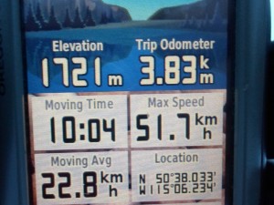
I picked up the new PLPP brochure/map at Barrier Lake Visitor Centre today and decided to GPS a lot of the trails and compare the distances to the brochure. I’m not saying my GPS is infallible, but I’m pretty sure some of the distances are inaccurate on the map.
The one which seems to vary the most from map to map is the section of Pocaterra between Whiskey Jack and Packers. I believe it is actually 2.9K, not 2.2K as shown on the new map. I’ve biked it in the summer and also got 2.9K. Marlene, as she screeched to a stop at Lynx after a fun and fast run down Pocaterra, had her GPS going and confirmed my distances. Just to be triple-sure, I skied it in the uphill direction later in the day and got the same result. The trail markers in PLPP show it as 3.0K, and Gem-trek shows it as 2.2K. I’d like to know why there’s such a discrepancy.
Did you know that Whiskey Jack is only 3.8K to the top from the Moraine junction? To get the full 4.3K as it shows on the map, you have to start at Boulton bridge, which I believe is the official trailhead. Yet on the back of the brochure it shows Whiskey Jack as being 4.5K. From Boulton creek parking lot, which is where I always start, it would be 4.2K. The elevation gain of WJ is listed as 220 metres, and that’s also from Boulton Bridge.
Conditions were great as you’ve already read from my reporters. When I ran into Ray, as he was descending Whiskey Jack, I yelled his name as we passed, and made him ski back up the trail so we could talk. I couldn’t ski back down to meet him or I would upset the reading on my GPS, so thanks Ray and Mary.
I covered 36K today on nine different trails. Whiskey Jack, Pocaterra, Lynx, Amos, Woolley, Meadow, Wheeler, Packers, and Tyrwhitt. As Ray mentioned, the only debris issue was the first bit of Tyrwhitt as it heads south from Lookout junction.
Around 5:30, a strong wind started to howl, it clouded over, and by 6 pm it was snowing lightly at Boulton creek parking lot.
The weather forecast: “Increasing cloudiness then periods of snow beginning this evening. Becoming partly cloudy before morning. Local amount 5 cm near the British Columbia border.”
I got several other discrepancies for trail distances but I’d like to ski them one more time to double-check. For example, Packers is shown on the map as 3.1K but the GPS shows it as 2.9K. Woolley, shown as 2.2K, GPS shows it as 2.0K.



My Garmin stopwatch has pretty consistently measured Whiskey Jack from Moraine as 3.45 to 3.5
I’ve had inconsistent readings on that one. The 3.8 which I recorded yesterday was descending, but when I went up, it gave me 3.4K. Considering Ray’s report, it sounds like 3.4 – 3.5 might be more accurate. Whiskey Jack is getting shorter as we speak!-Bob
Hi Bob,
I’ve carried my GPS for 5 years, and have lots of saved files. I checked some numbers:
Pocaterra (WJ to Packers) – I agree with your 2.9Km (My PLPP trail map shows 2.3Km)
Whiskey Jack – top to Moraine Jct: I have 3.4Km (your reading 3.8Km)
Woolley – I agree with your reading of 2.0Km
Blueberry Hill – my GPS shows 3.5Km. PLPP trail maps show 3.2Km.
Tyrwhitt (lookout jct to elk pass) – my GPS 4.8Km PLPP trail maps 4.5Km
My GPS elevation readings vary slightly each trip, often +/- 5 to 7 meters.
I think a lot of map distances come from a time before GPS availability.
Hi Bob,
As requested: My garmin read 20.21k where I met you and recorded 23.88k when I got to the Pocaterra Hut. Hope that helps! Just a note to the above comment, I’ve compared my Garmin and iPhone gps and the iPhone was not as accurate?
Great meeting you today, you have done great things for our sport!
Thanks! That would make the distance from Pocaterra hut to Lynx 3.67K. The map, when adding all the segments together, comes to 3.6, so that one is pretty accurate. I’ll check it with my GPS one of these days. -Bob
Hi Bob – Thanks for starting a conversation on the PLPP map distances. Yesterday, I skied with Eric Leavitt and his I-Phone GPS recorded 28.9 km. I checked the map distance total for our day at home and all trails skied totaled 31.4 km. That’s a 9 percent difference over the GPS number.