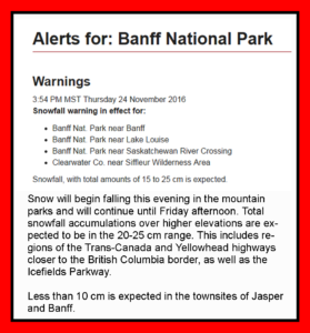
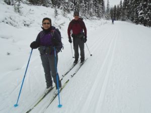
–SkierBob and Nona on Moraine Lake road. Photo by Don Crowe.-
Moraine Lake road has received 1-2 cm of new snow since Monday’s tracksetting but the forecast is for lots more tonight and tomorrow.
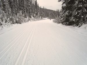
Today, conditions on MLR were still excellent with well-defined tracks and cold snow. This new snow should allow some fresh tracksetting on MLR and the Great Divide, and hopefully a few more trails will have enough snow to allow grooming.
For Kananaskis Country, the most optimistic forecast is from Ventusky predicting 16 cm for Mt Shark and 7 cm for Elk Pass. The Weather Network predicts 5 cm for Boulton Creek. The Snow Forecast predicts 6 cm.
I arrived at MLR around 12:30 pm and couldn’t even get a spot in the parking lot. The air temperature was -1°C and the snow was -3. Good old VR45(-2/-8) worked well again, but I noticed the tracks were a lot faster today than they were on Tuesday.
It was a gray, overcast day. When I reached the top of the hill, I could sense the storm front moving in. The wind started blowing and some very light snow started falling.
For those of you interested in Fairview trail, it is still very rough but has plenty of skier tracks on it. This new snow might be just what it needs to get some packing started.
Thank you to Nona and her friends for supplying the best photo of the day, and to Chuck for the next best when he caught me in action.
For those who are interested in skiing all the way to the lake, check the Trip Report and photos from Chuck who went there today.


I know this is not a trip report but just wanted to share a really good 5 minute giggle on x-country skiing. If any of you are CBC radio listeners you may be familiar with the segment “This is That”. Goggle onto this site and listen to their take on x-country skiing. Total satire as it blames Nordic skiing for the downfall of our youth and how skiing can lead to a hedonistic lifestyle. Maybe that is why we are all addicts??? Maybe this is not satire??
Thanks for sharing. It’s priceless! I like the toboggan registry piece as well.
I have also been looking at the Alberta climate info site, and would like to know something about the reliability of the data. Since they show no new snow at Lake Louise, I wonder if I can trust any of the other data.
Does anyone else have experience or comments about this?
Thanks!
Kananaskis Public Safety is forecasting 20 cm but that would be at higher elevations than we are generally skiing at. http://skierbob.ca/wp-content/uploads/2016/11/Mike-Koppang.png
Do you multiply precipitation by 10? That is what I usually do.
I am having issues with the avalanche.ca reports from the new Kananaskis weather stations, as there seems to be a lot of noise in the system 🙁
The Mud Lake location(near Chester Lake day use) shows an increase in snow depth of 6 cm since midnight. It went from 15 to 21 cm. http://www.avalanche.ca/map?panel=weather-stations%2F3 The other 3 locations are not really relevant to xc skiers.
Bob, how do you get your forecast snowfall numbers out of Ventusky?
I see that they give us ‘Precipitation’ in terms of mm of water, or we can see Snowfall Accumulation in cm. As I run the time on the model, I don’t see the snowfall accumulation changing much, if at all, over the course of today, yet the precipitation shows up to 4.1mm of rain. What’s your secret?
And great photos of Bob the man!
I doubt if I can explain it so that it makes sense, but here’s a screen capture that might help. It shows Mt Shark receiving 15 mm of precipitation(15 cm of snow) between Thursday night(11/24 11 pm) and Sunday. http://skierbob.ca/wp-content/uploads/2016/11/Ventusky.png
Thanks Bob. Your example showed me that we can set the time base for the accumulated precipitation. Cheers!