Update Jun 28: Volunteers required to repair trails at Canmore Nordic Centre
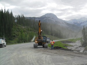
At first I thought the Command Centre trailer was one of those book trucks that sell books like The Best Hunting Rangefinders of 2018 Reviewed: The Definitive Guide, but no such luck. I drove to Sibbald Flats today, one of the few areas in K-country which is still open and accessible. Coming from Canmore, I went down Hwy #40 for 7K to to the turn-off to Hwy #68. At the junction was a sizeable law-enforcement presence, with a command centre and five police vehicles. This is as far as you can go, and you are definitely not allowed to go in on foot according to what I was told at the Barrier Visitor Centre.
This map will show you what’s closed in K-country. Don’t think you’ll go in anyway. Conservation officers appeared to be handing out tickets at the trailhead to Quaite valley along the #1 Highway. There was yellow tape indicating the trail was closed. You could see from the road that a large portion of the trail was deeply eroded.
Canoe Meadows is closed. The kayak course on the Kananaskis river is reportedly damaged.

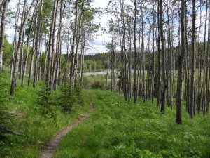
Eagle hill trail at Sibbald flats is open and accessible. It has a few muddy spots and some flowing water.
Heart creek trail and parking lot is closed. The access point to Heart Mountain along the Trans Canada hwy is taped off as well. Pigeon Mtn, Mt. Allan, and Wind ridge is closed.
Getting back to my trip to Sibbald flats, Eagle hill trail is open and passable with some muddy spots and a bit of flowing water in places. Powderface road is closed, so there is no access to Cox hill, Tom Snow, or Jumpingpound summit/ridge. There are a few other trails open at Sibbald flats such as Ole buck loop and Deer ridge. Be prepared to encounter swarms of mosquitoes.
From the Calgary Herald: “Officials won’t speculate on how long it will be closed, but they guarantee most of K-Country won’t be open for the long weekend as a result of the flooding that swept through southern Alberta last week. Read more K-country changed forever by flooding
Map of the Sibbald flats area
Today’s photos:


Can you post some volunteer info I got? I’ll em-mail it to you shortly. I will be helping too, least I can do for a place I love so much.
Gord
Yes, please send it. -Bob
Thank you for the map. It is very useful, but very disheartening 🙁
It looks like most of Banff is closed too……..