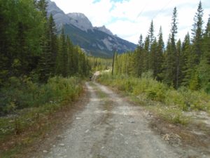
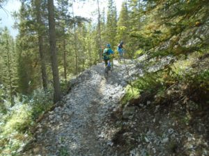
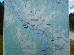
Spectacular views along the High Rockies trail between the dam and Driftwood
I hit one high point on this trip at 1740 metres as I neared Spurling creek, but the real high point of the day was right at the end. As I was returning at dusk I heard the haunting call of a loon on Goat pond. It was a memorable and fascinating end to my first foray on this section of the new trail.
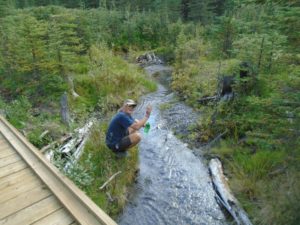
Markus, who is biking from Prudhoe Bay, Alaska to the tip of South America, stops at one of the many streams for a refresher.
My first instalment on the High Rockies trail covered Goat Creek trailhead to Goat pond at 7K. Actually, a little beyond Goat Pond to the end of the boardwalk at 8.9K, but I’m overlapping a bit because Goat Pond is an access point.
Between Goat pond and Spurling creek there are two access points: the dam, and Driftwood day use.
You’ll encounter plenty of variety on this leg of the High Rockies trail. Start by crossing an 860-metre gravel road from Goat pond parking to access the High Rockies trail on the other side. Although it’s not officially part of the HR trail, I will include the 860 metres in my distances.
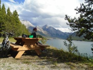
There are 10 picnic tables at Driftwood which make it easy to stop and admire the scenery while having lunch
The trail follows the powerline on very nice double-track, crossing numerous lovely streams on newly built bridges. The boardwalk gets you across a 200-metre swampy stretch, then you resume pleasant cycling on the double-track. At 4.7K you reach the campground and the dam road. Let me rephrase that: “the road across the dam.” Before you cross the dam, look for a trail marker on your right.
Upon reaching the end of the road across the dam, you’ll have to bike on the Smith-Dorrien for about 50 metres at which time you turn into the parking lot. There’s a tiny “Trans Canada trail” sign on the post as you enter the parking lot, and it’s your only indication that you’re on the right track.
The 2.9K from the dam to Driftwood is single-track and a mixed blessing. This section offers the most spectacular views of the mountains and Spray lake as it meanders on the bank above the lake. That’s mitigated somewhat by the fact that the trail is just below the Smith-Dorrien road which can be noisy and dusty. The trail itself is fun as it twists and turns, but is quite rocky.
If you thought that was rocky, wait ’til you cross the road on to the east side of the Smith-Dorrien. You not only have a rocky trail but now you’ll be climbing with plenty of ups and downs. From crossing the Smith-Dorrien to the high point, you’ll gain 47 metres of net elevation over 1.5K. From the high point, it’s a quick downhill to Spurling Creek on a much smoother trail. It reminded me of the West Connector of the Highline trail at Canmore with it’s high-banked turns.
At Spurling creek there’s a pull-out along the Smith-Dorrien. This is also the trailhead for West Wind Pass. Total distance from Goat pond to Spurling creek is 10.7K one-way.

