
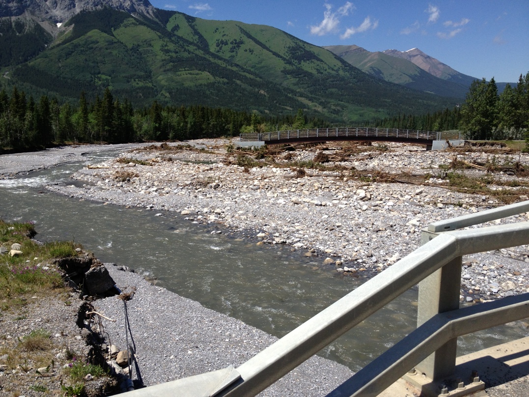
The Evan-Thomas creek has carved out a new channel and no longer flows under the bridge on the Bill Milne trail. This is just a few K south of the village.
Highway 40 into Kananaskis country is open as far as Wedge pond. There are no trails open, however, just some of the day-use areas. I observed what appeared to be some hikers who had disobeyed the “closed” signs and were being ticketed by conservation officers.

This police presence at Wedge pond will stop you from going any further south
The best we could do was a hike on the village rim trail at Kananaskis Village, and a pleasant walk around the Mt Lorette ponds, but one small bridge is closed even there. Unless it opens in the next few days, Tessa and I are going to miss our traditional July 8 birthday hike on Porcupine creek.
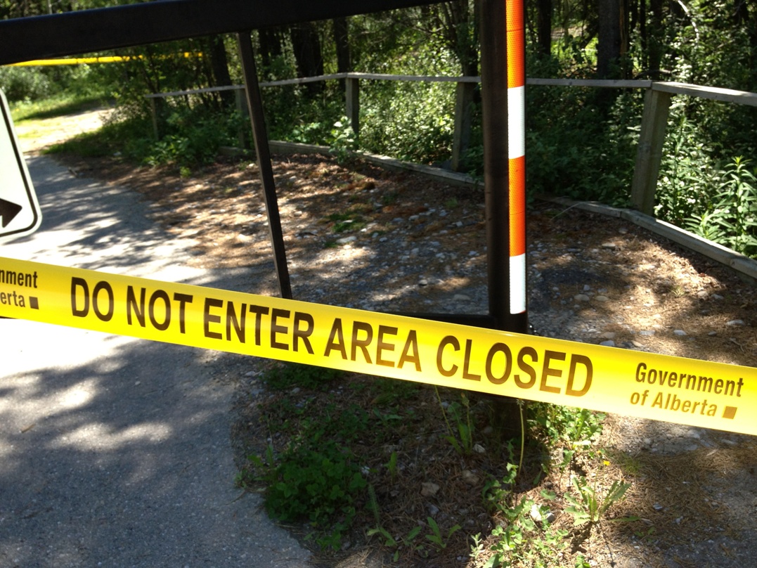
This is the most common sight at most trailheads in Kananaskis
When you drive down Hwy 40 you’ll notice many changes to the landscape. Raging water has carved out new gullies along the road. When hiking in the past, I often crossed dry creek beds, where I had never ever seen a trace of water, and wondered when they had last had any water flowing in them. Now many of these previously dry creek beds which hadn’t seen water in my lifetime are much deeper and wider.

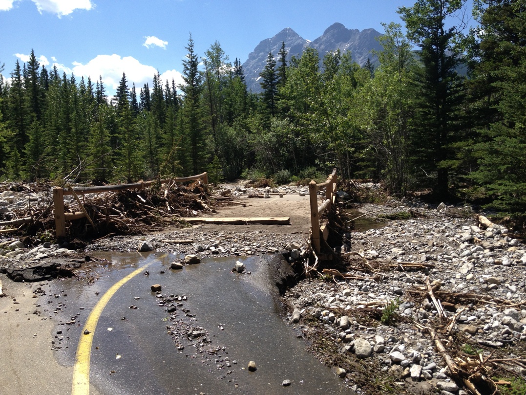
The access road to Ribbon creek trailhead.
If you go south of the village, there is a temporary one-lane bridge over Evan-Thomas creek where you may have to stop and wait your turn. Construction vehicles and trucks are common sights heading south into Peter Lougheed prov park, but no private vehicles are allowed.
This little bridge on the Bill Milne trail is still intact but covered with debris. The creek under this bridge is normally a tiny trickle of water.
This map will show the closed areas in Kananaskis. It’s been updated and now shows the Powderface trail is open as far as the Dawson trailhead. Has anyone been there? I’m wondering if the trails(Cox Hill, Tom Snow) are open.
Volunteers required. This was posted by Kananaskis Country Public Safety:
Many parks and recreation areas in Kananaskis Country remain closed by Ministerial Order as well as a State of Local Emergency.
Kananaskis Country is beginning the post-flood recovery. If you want to volunteer as an individual or organization, please register here:
https://
Volunteers will be contacted as programs are developed.
******
Banff National Park
I read on Facebook that the Lost Horse creek bridge has been repaired and that Redearth creek in Banff is passable again. Shadow lake lodge will be opening this Friday. You can stay overnight, or if you’re a daytripper, they offer afternoon tea for $15.
I looked at Bike Pirate and it looks like somebody was able to access Cox Hill after fording a creek that usually has a bridge (http://www.bikepirate.com/trail-report/). He didn’t recommend accessing Tom Snow from the Dawson trailhead. Based on this trip report, I’d assume that the highway is open.